
The History of University Heights
The Mayors of University Heights (Idlewood Village):
|
||||
 |
 |
 |
 |
 |
Michael Dylan Brennan
|
Susan K. Infeld
|
Beryl E. Rothschild
|
Irving W. Konigsberg
|
Earl W. Aurelius
|
 |
|
|
|
|
John J. Howard
|
A.R. Silsby
|
Oscar F. Alexander
|
Michael Scheinder
|
A.R. Silsby
|
Beginnings in Idlewood Village
Idlewood Village western boundaries between 1907 and 1912. Visit Cleveland Public Library’s interactive county maps (http://peoplemaps.esri.com/cleveland-maps/)
Electors from the proposed Village of Idlewood met at Gillon Blacksmith Shop in Warrensville Center on May 14, 1907 to vote on whether or not to establish a new village. 58 votes were cast, 33 in favor of establishing the Village of Idlewood. The area that voters established as Idlewood Village was approximately 3 square miles with a population of roughly 400, full of rolling hills, farm fields, groves, and brooks. Carved out of the northeastern section of Warrensville Township and the southeastern part of the Village of Cleveland Heights, the boundaries spanned east to Lee Road and south to North Woodland Road, as Fairmount Boulevard was known, south to Shaker Boulevard and east to South Green Road. The village was rural; the vast majority of residents were farmers with others working as a butcher, stone mason, blacksmith, dressmaker, street construction workers, and a postal worker. There were only 6 streets in the village: Green Road, North Woodland Road (later Fairmount Boulevard), Lee Road, Taylor Road, Silsby Road, and Center Road.
This all changed on May 23, 1914 when the petition to annex land to Cleveland Heights went into effect. Totaling 3.3 square miles, Cleveland Heights annexed the land west of Eaton Road and south of Silsby Road, creating the boundaries of the city today, and Shaker Heights annexed the land south of Fairmount Boulevard. The map to the right shows some of the additional land included in the boundaries to the south of Silsby Road and to the west of Eaton Road. When the annexation became final, the population of Idlewood Village was reduced by roughly two-thirds to just over 70.
With the change in boundaries, the political landscape of Idlewood Village changed drastically in one council meeting. In a special meeting of the village council on April 16, 1914 the village council voted to move the town hall from the northwest corner of Warrensville Center Road and Fairmount Boulevard (it was located in what is now the traffic circle) to Warrensville Center Road and Idam (Silsby) Road. Additionally, the resignations of Council President Pro Tem G.E. Penty, Councilmen T.E. Corlett, and C.W. Griswold, and J.E. Sayles, and Clerk M.J. Schneider were accepted; in their place A.R. Silsby was appointed Council President Pro Tem, R.J. Cowle, E. Elbrecht, and M. Elbrecht appointed to council, and George Penty appointed as clerk.
Later in October 1914, Mayor Oscar F. Alexander resigned as mayor, and A.R. Silsby was appointed in his place.
From Idlewood to University Heights
Resolution 992 passed the Village Council on February 3, 1925 and was signed by then-Mayor Howard to officially change the name of the village from Idlewood to University Heights. Local legend has it that it was the wife of the councilman who introduced the resolution, A.R. Crawford, made the suggestion to change the name of the village to honor John Carroll University moving from its Ohio City location (now Saint Ignatius High School) to Idlewood Village.
After failed negotiations with the Cleveland Railway Company to provide better public transit to University Heights Village, Ordinance 2065 passed on November 1, 1927 established a municipal transportation service managed by the newly created Transportation Department and employing 2 bus operators, paid $7 per day. Additionally, the city purchased a 17-passenger Studebaker bus for $1,250. Unfortunately, the transportation service did not perform as well as the village council had hoped, and a motion was passed on April 24, 1928 to discontinue the bus service on May 5, 1928.
The Village of University Heights’ population became a city in 1940, when the 1940 Census showed that the town had a population greater than 5,000 residents. When the town became a city, a charter committee was formed, and the following year voters approved the new charter on June 3, 1941, setting up a strong-mayor form of the mayor-council government.
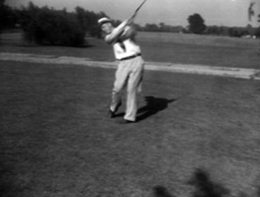
A golfer at the University Heights Golf Course, located between Warrensville Center Road and South Belvoir Boulevard along Cedar Road. Visit the Cleveland Memory project at (http://images.ulib.csuohio.edu/cdm/singleitem/collection/clevehts/id/2145/rec/1)
A Growing, Vibrant Community
From 1940 to 1970, the City’s population grew from 131 to 17,055, thriving and enjoying widespread growth and prosperity, like much of the greater Cleveland area. Civic life flourished and the community developed, with houses popping up all across the city–over 2,500 homes were built in the 1940s and 1950s. In a letter to the residents of South Belvoir Boulevard, Mayor Earl Aurelius describes how South Belvoir went from nothing more than a dirt road to the grand, tree-lined boulevard seen today.
In 1966, University Heights held its first Memorial Day Parade. To this day, University Heights is proud to have the longest-running east side parade, celebrating its 50th year in 2016.
The southeast corner of Cedar and Warrensville Center Roads was home to the Huge brothers’ 9-hole golf course, spanning from Warrensville Center Road to the backyards of homes on South Belvoir Boulevard. When the golf course closed, the Huge brothers allowed neighbors to roll up the grass and use for their owns yards. The brothers’ golf course was broken up, running Miramar Boulevard through the property, May Company purchased a large parcel on the west side of Miramar Boulevard at the corner of Cedar and Warrensville Center Roads to build May on the Heights. The Cleveland Heights-University Heights Board of Education built their administration building and a junior high school, Wiley Junior High (later Wiley Middle School), on the eastern side of Miramar Boulevard. Behind the Wiley facility, the City built its first municipal pool for its residents, breaking ground in March of 1957 with snow flurries flying.
In 1978 Beryl E. Rothschild was elected mayor of University Heights, one of the first and longest-serving female mayors in the United States. To this day residents fondly remember Mayor Rothschild’s strong will, determination, and boisterous voice for the issues she championed during her time in office.
Town Hall’s History

The University Heights Town Hall as it looked in 1932. Visit the Cleveland Memory project at (http://images.ulib.csuohio.edu/cdm/singleitem/collection/clevehts/id/2097/rec/1)
By the late 1910s, the village outgrew the wood-frame town hall on land leased from The Van Sweringen Co. for $50 per year (located in the area of present-day 2324 Warrensville Center Road). On May 27, 1922, Elizabeth Dooley, the owner of a 1.89-acre property at the corner of Center Road and Silsby Road, sold her land for $13,228.29 (roughly $187,000 in 2015) to the Village for a new town hall.
On June 16, 1925, the Village Council established the “Town Hall Construction Fund,” starting it off with $10,000 from the enforcement of state liquor laws (alcohol prohibition money). Additionally, the Village council approved the issuance of $40,000 in bonds for a new town hall. The Village hired Adrian Foose, also the architect for St. Emeric Chuch, and George Fox as the architects of the new town hall.
Almost a year after the establishment of the Town Hall Construction Fund, on April 20, 1926 the Village Council appropriated $50 for Mayor Howard and his clerk to use in the formal opening of the new town hall, selling the old town hall the same year for $5,000 (roughly $67,000 in 2015). In total, $54,178 (roughly $731,000 in 2015) was spent on constructing, landscaping, and furnishing the new Town Hall of University Heights.
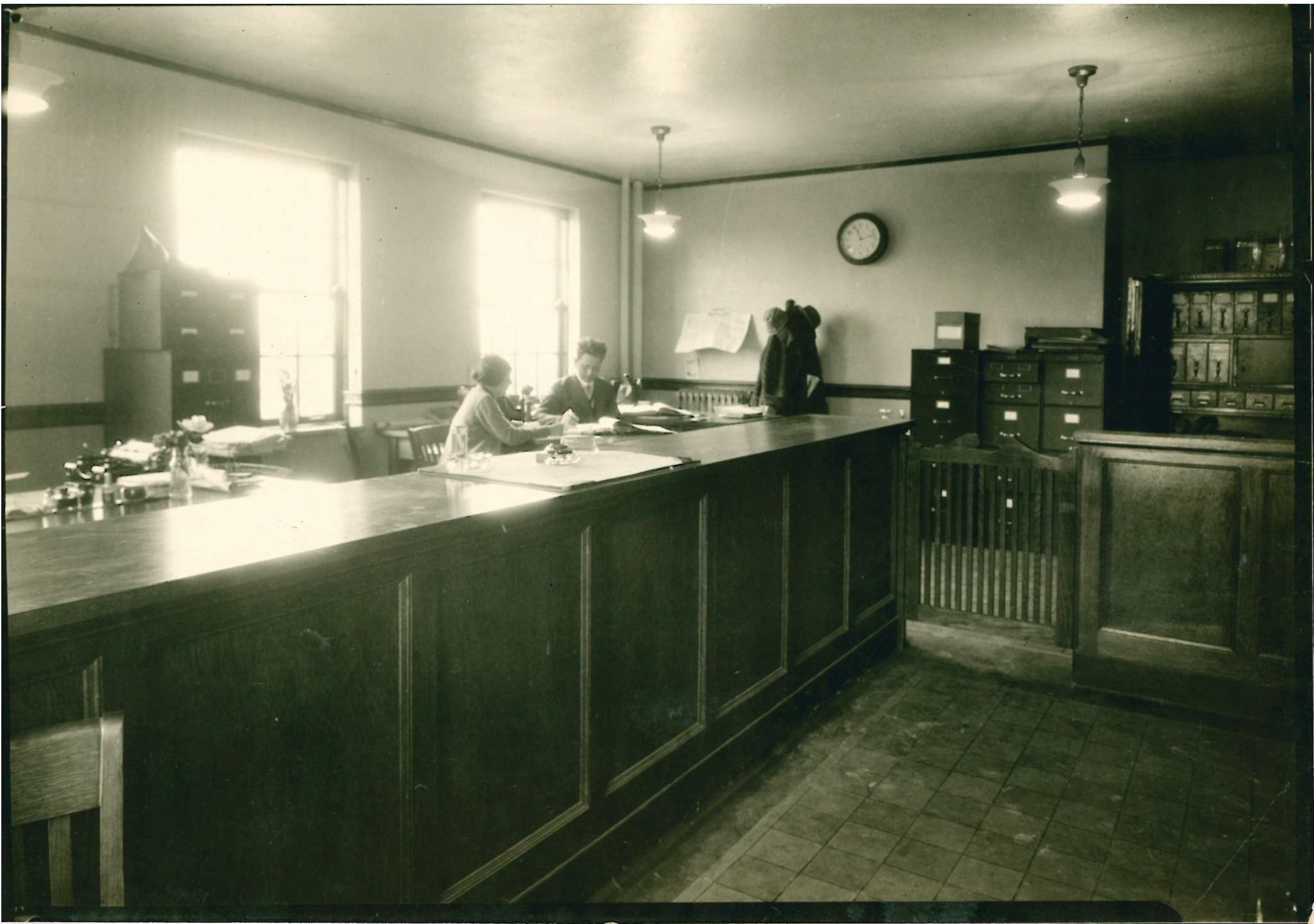
The original lobby of City Hall, when the entrance faced Warrensville Center Road. (Taken from the City Hall Archives.)
At the October 3, 1960 City Council meeting plans to modernize the City Hall were referred to the Council’s Building Committee for consideration. The following year at the June 5, 1961 City Council meeting, Ordinance 61-35 passed, awarding the modernization of City Hall to the Schirmer-Peterson Company in the amount of $17,694. The modernization included moving the front door and the lobby off Warrensville Center Road to off the parking lot (where it is today), turning what used to be the Building Department and general administration office into a larger office area where the Finance Department is today, as well as fresh paint and some new floors, bathroom updates, and installation of wood panelling in the new lobby and conference room.